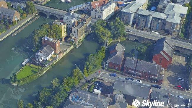
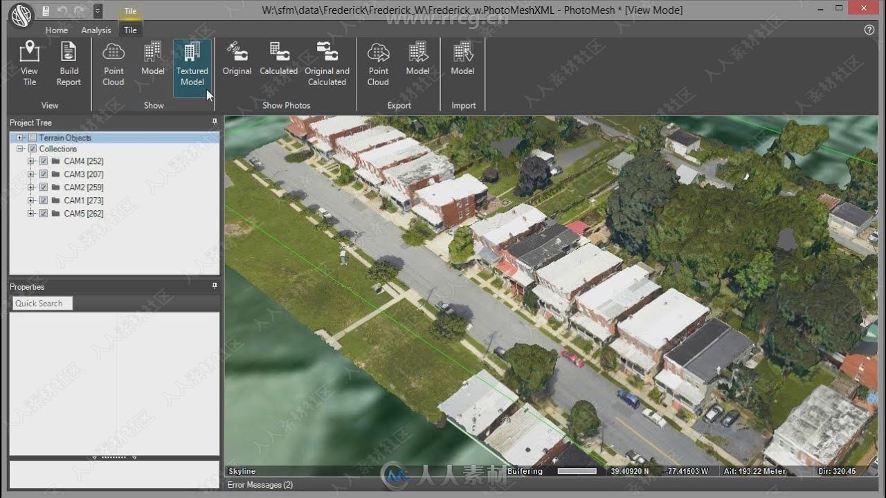
PhotoMesh fully automates the generation of high-resolution, textured, 3D mesh models from standard 2D photographs. This breakthrough application combines unlimited scalability with superior precision to produce consistent and accurate 3D models that enhance the realism of any 3D visualization.
Features:
Unlimited Scalability:
-Grid computing and tiling mechanism support ever-increasing dataset sizes
-Elaborate tiling mechanism enables efficient handling of massive quantities of input imagery
-Use of network fusers dramatically accelerates processing time by enabling multiple computers to share the processing load
Superior Precision:
-Accurate representation of intricate features, details, geometry, and color
-Full-3D mesh model
-Advanced color balancing produces seamless, realistic models
-High-quality texturing
-Seamless fusion of multi-resolution source data
-Powerful compression algorithms avoid any unwanted loss of geometric accuracy
High Performance:
-Powerful and fast
-Exploits the power of graphics processing units for general purpose computation
-Multi-core and multi-computer processing allow for unlimited source data and dramatically reduce processing time
-Powerful engines can handle enormous quantities of input and output data
Interoperability:
Compatible with vast number of CAD and 3D solutions
-Produce georeferenced 3D models in any coordinate system
-Produce dense point clouds with detailed color information that can be used in most point cloud analysis software
-Create 3D mesh models with level-of-detail and paging directly compatible with TerraExplorer
-Generate true-orthophotos and DSM compatible with all standard GIS tools
Exceptional Usability:
-Straightforward photo acquisition and automatic processing
-Directly output a geometrically precise, photo-textured 3D model, without mapping texture to 3D geometry
-Photograph subject from any mobile phone, compact digital, DSLR, photogrammetric, or multi-camera system
-Reconstruct subjects, ranging in size from centimeters to kilometers